LANDWORKS BY REGENERATES
Land-use design grounded in the reality of place.
LandWorks helps landowners, farms, estates, project developers, and landscape initiatives translate regenerative ambition into integrated land-use systems that are technically grounded, co-created with the people who shape them, and built for long-term resilience.
Every place has its own logic. The work is learning how to design with it.
Real places do not respond well to generic or fragmented interventions. Water, slope, soils, access, ecology, production, infrastructure, and management realities all shape each other. The challenge is to understand how the place actually works before deciding what should happen there. LandWorks helps translate that understanding into spatial and technical logic: what the land can support, where interventions belong, and how they need to fit together.
Design outputs that turn place-based understanding into action.
Depending on the scope, LandWorks can produce anything from a focused site concept to a full regenerative master plan or landscape transition pathway: always grounded in how the place works, what the project needs to decide, and what can realistically be implemented.


HOW LANDWORKS WORKS
Five steps, from shared understanding to implementation pathway
The scale may be a farm, a settlement, a watershed, or a bioregion. The technical depth changes with the project. The method remains consistent.
We align the people.
Project owners and key stakeholders develop a shared language, shared direction, and a grounded definition of regeneration for the context.
We read the place.
Field observation, stakeholder knowledge, existing data, and pattern recognition reveal what is already known and what is missing.
We analyze the layers.
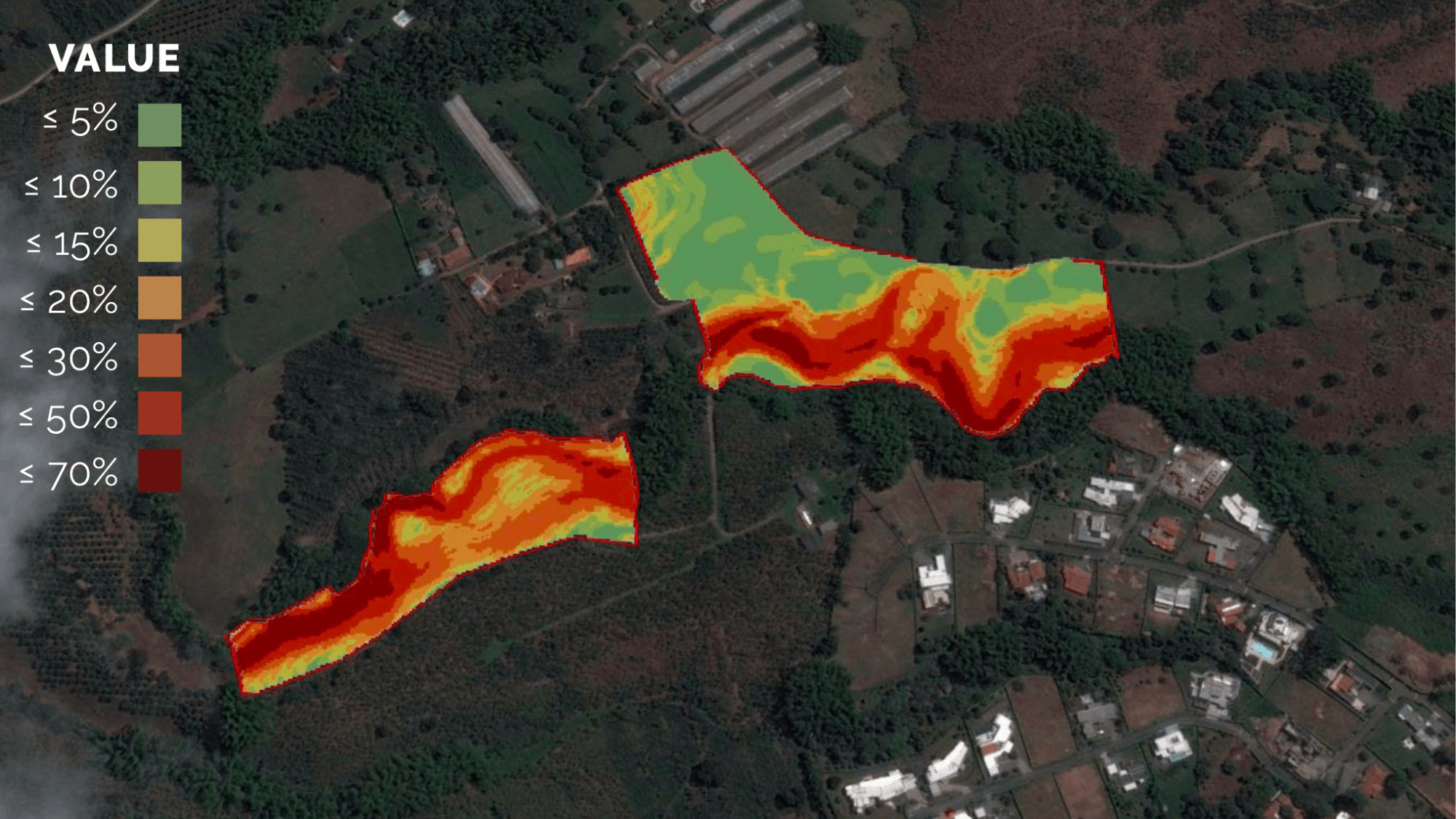
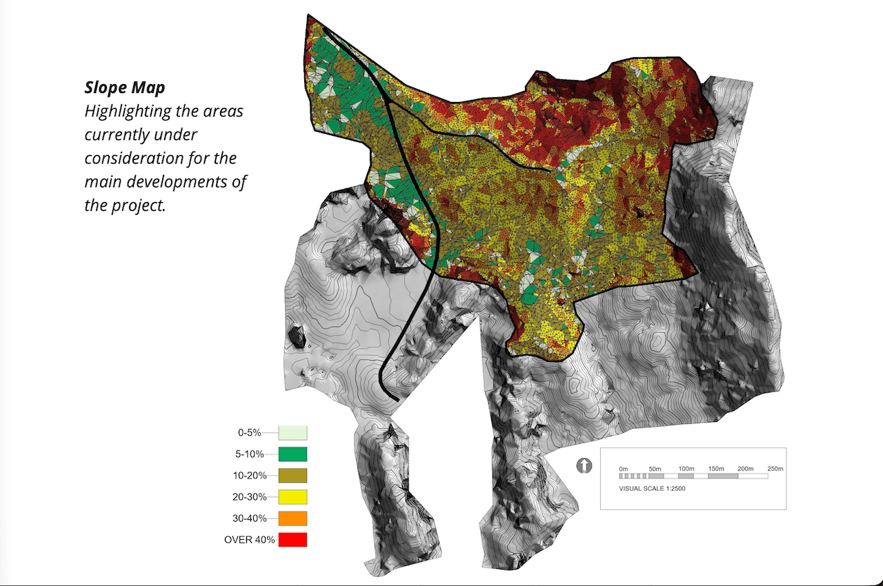
GIS, mapping, and technical assessment make visible climate, landform, water, soils, access, ecology, infrastructure, production, human use, and management realities.
We integrate through design.
We bring the layers together into a coherent system. Water, access, production, restoration, and infrastructure are designed in relation to each other, not as separate interventions. This is where the spatial and technical logic of the place takes form.
We support the pathway forward.
The design becomes an implementation pathway: priorities, sequencing, phasing, and the next decisions to make. The work moves from understanding to action, with the project team equipped to move forward.
Resilient design starts with how the place works as a whole.
Land and landscapes function as integrated systems. The value of analysis is not in looking at each site condition separately, but in understanding how key landscape characteristics shape each other and what the place can realistically support. When water, landform, soils, access, ecology, infrastructure, production, and management realities are read together, the design becomes a system that can hold up over time, not a set of isolated interventions.

From farm sites to living landscapes.
LandWorks can support focused site-level questions as well as larger landscape and bioregional planning needs. The technical depth changes with the scope. The method does not.
Farm / Production site
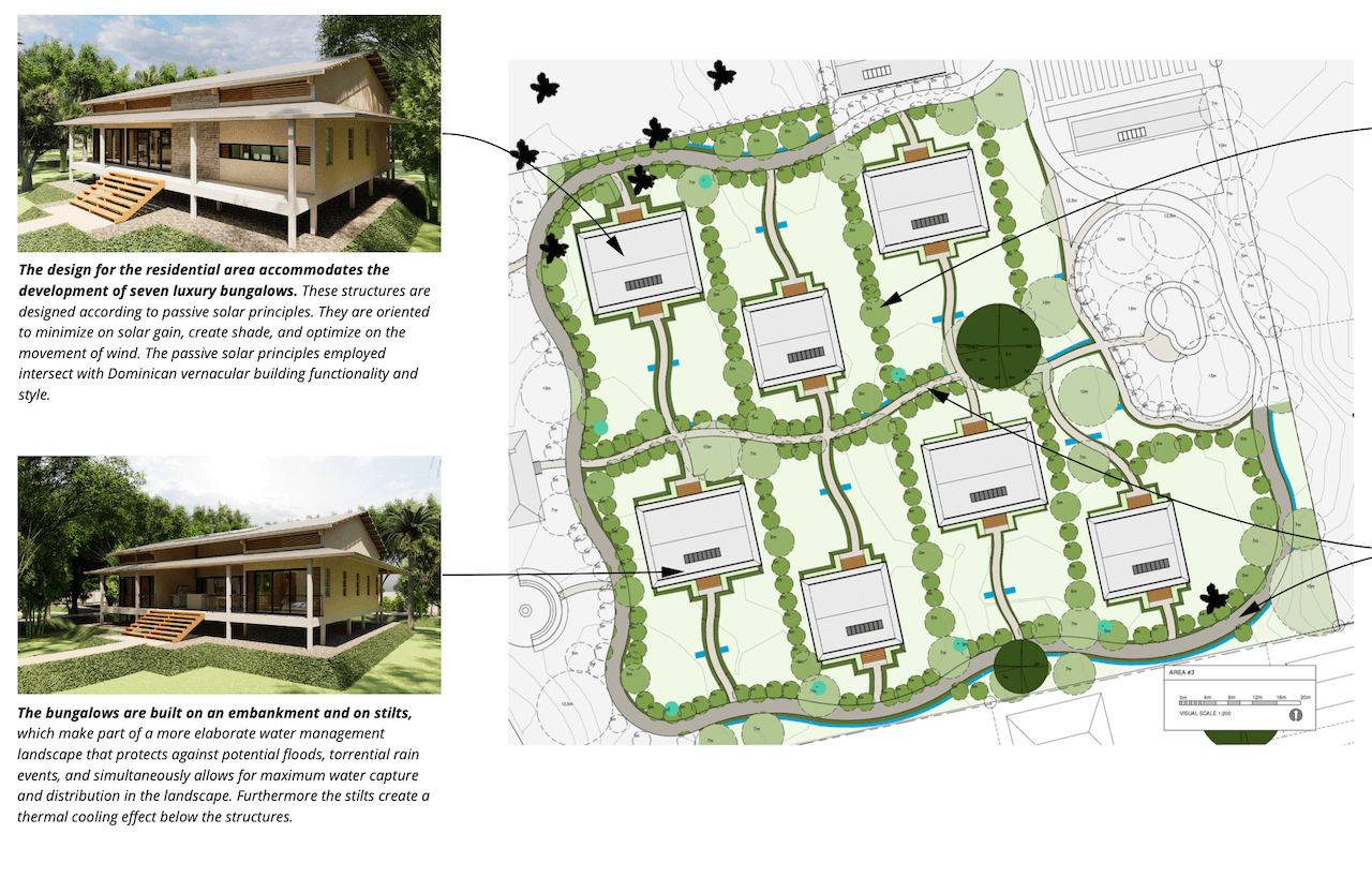
Site-level design for water, access, agroforestry, production zones, and practical implementation phasing.
Estate / Landholding
Integrated master planning across land-use allocation, infrastructure, restoration, productive systems, and long-term management.
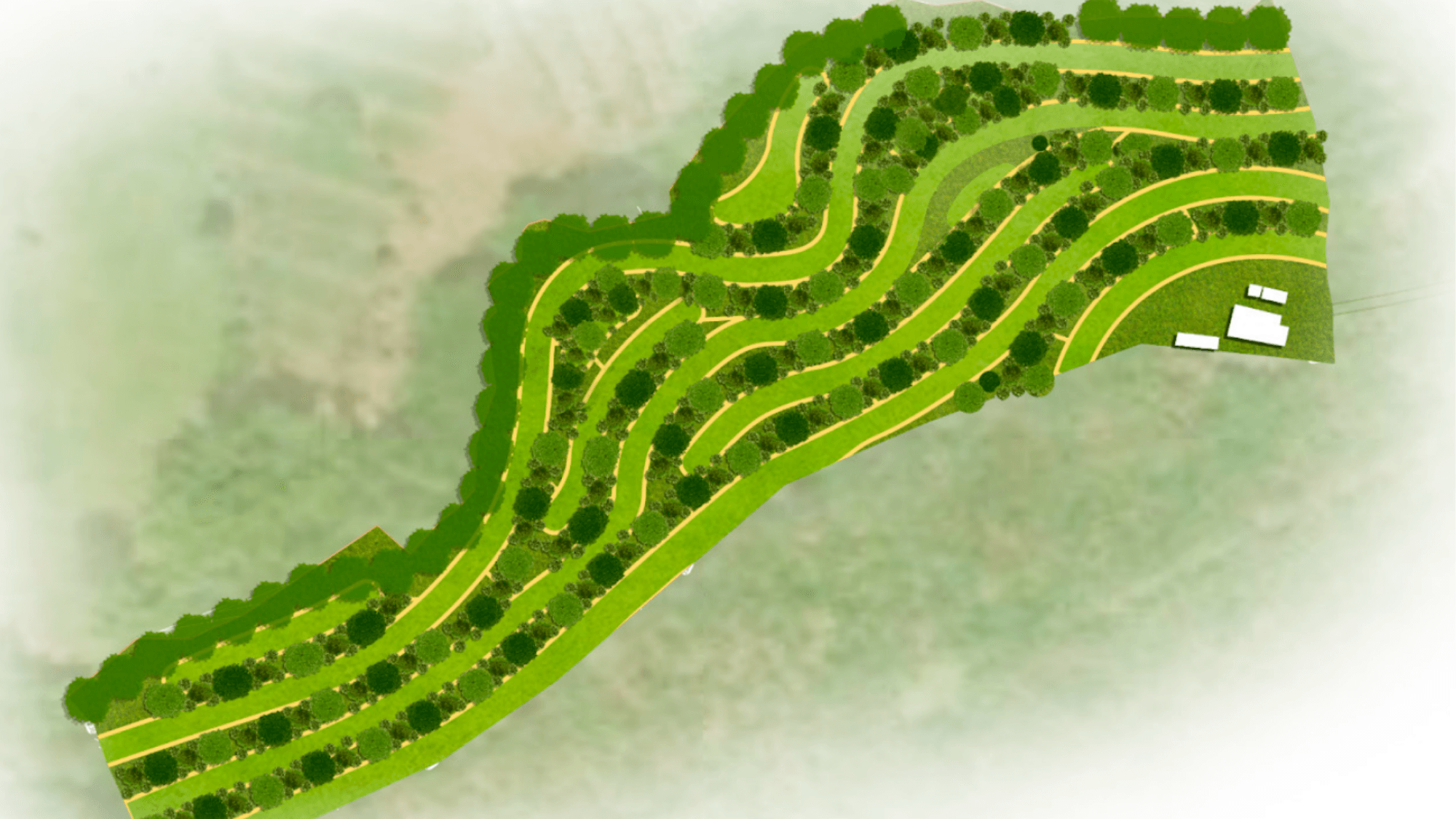
Settlement / Eco-village
Settlement planning that brings together housing, food systems, water, access, ecological integration, and community infrastructure.
Landscape / Bioregion
Landscape-scale strategy for watershed logic, ecological corridors, conservation-production systems, regional land-use patterns, and multi-stakeholder coordination.
COLLABORATIVE DESIGN
Good design begins by asking better questions.
Before drawing lines on a map, we work with project owners and key stakeholders to clarify goals, surface local knowledge, align expectations, and define what regeneration needs to mean in context.
The people closest to the land often hold critical knowledge. LandWorks helps make that knowledge visible, connect it to the spatial and technicawl realities of the site, and turn it into better design decisions.
The best design decisions emerge when local knowledge and technical analysis meet.
SELECTED LANDWORKS WORK
Work that shows the
method in practice.
Selected examples across climate-resilient cropping concepts, eco-village master planning, farm-level land-use design, and technical water and landscape assessment.
TRUSTED BY PARTNERS AND CLIENTS ACROSS THE WORLD


Start with a site or landscape assessment.
Whether the project is a farm, estate, settlement, or landscape initiative, the first step is a structured conversation about the place, the people involved, the decisions ahead, and what the land can realistically support.